Source: Northampton Battlefield Conservation Plan published by Northampton Borough Council
There have been comments under the article about the damage to the battlefield in the local Chronicle newspaper
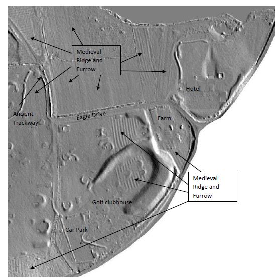
website that the Eagle Drive/ Golf Club side of the battlefield is mostly made up ground. So as to set the record straight, please see this section of the battlefield Lidar Survey, which clearly shows the medieval ridge and furrow across the area. In the area behind the clubhouse it appears that a spoil heap has been dumped on top (in a horseshoe), so the original ridge and furrow is probably still underneath. Actually, most of the ridge and furrow is in such good a condition, that you only have to look across the landscape to see for yourself.
